RAMS (Road, Air and Marine Speedometers) is our series of Mobile GPS Dashboard apps with unique sets of features suited specifically to different modes of transport.
The apps of the series share a core Journey Recorder component designed for high accuracy, memory and power efficiency, fault tolerance, and the capability to record for any length of time. We have focused on the following key aspects to create a high-quality mobile app experience. This article explains the key aspects we’ve focused on while developing these apps, and how you can customise them to get the most out of your journey recording experience.
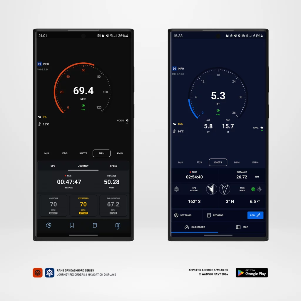
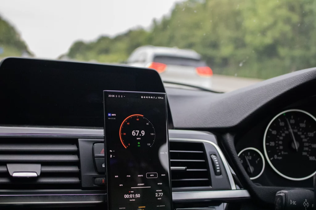
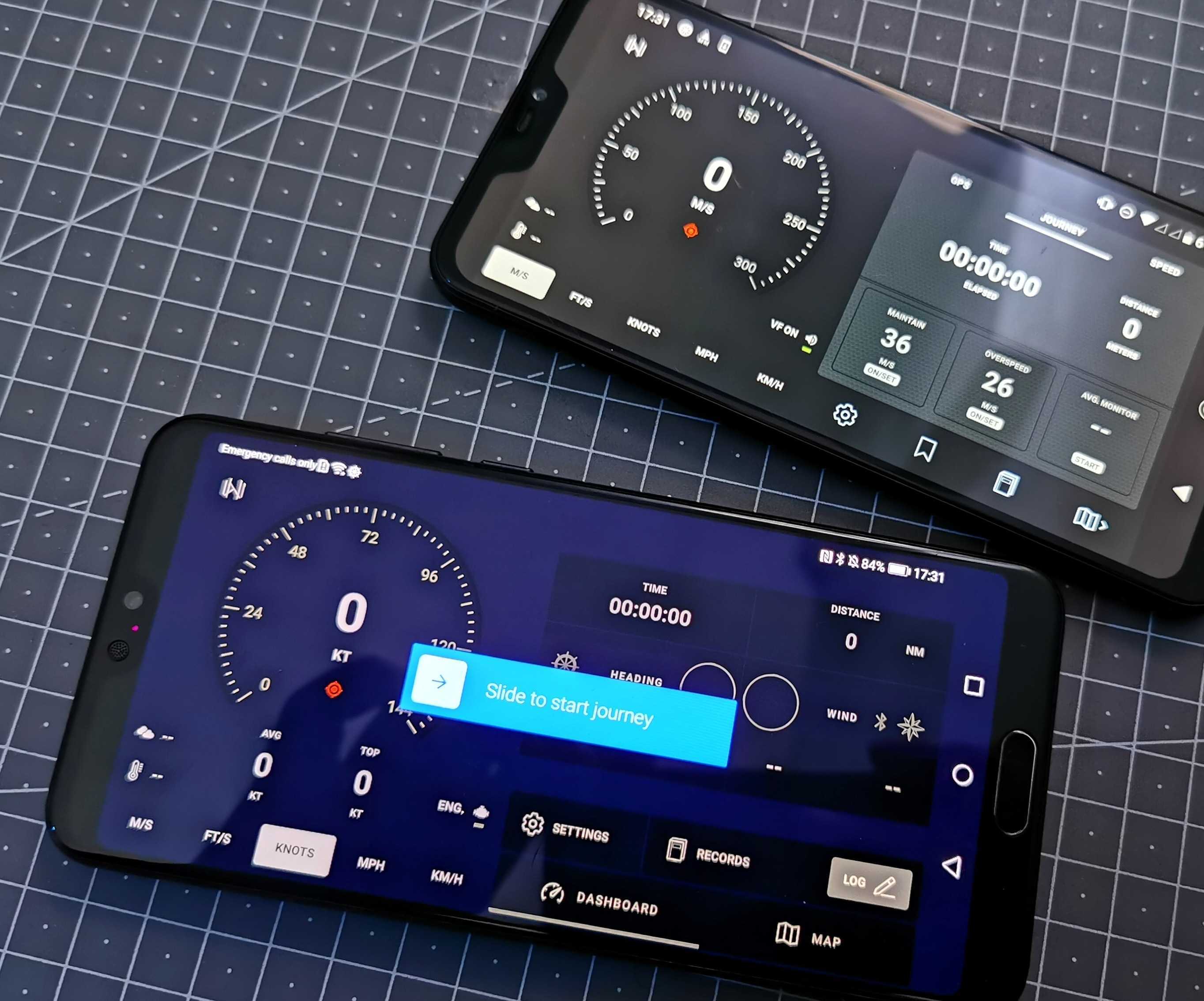
The RAMS GPS Dashboard Series: Velocity GPS Dashboard for road vehicles (left), and Mariner GPS Dashboard for marine vessels
GPS accuracy
GPS chips in mobile phones and smart watches are generally capable of accuracy within 4 (sometimes 3) meters (9.84-13.12 feet). The default settings of the app are set to give you measure your speed accurately. However, strong signals cannot be guaranteed in all situations, and will most certainly vary as you travel though built-up areas. Nearby obstructions such as buildings, machinery, and unfavourable weather conditions can all affect signal strength.
You can customise the following settings to optimise the app for your type of journey:
- Update Interval – The frequency of location updates in seconds. A shorter interval provides more precise and frequent updates, ideal for fast-paced road or marine travel, or when you require a lot of detail in the recording. A longer interval conserves battery, and is more suitable for steady, long-distance journeys by road or sea.
- Minimum accuracy – Set your minimum required GPS accuracy in meters. The lower the value, the more precise. Customise this value to only accept the most accurate readings from your GPS.
You will find these GPS settings in the Settings menu under ‘GPS Connectivity’, highlighted in red below:
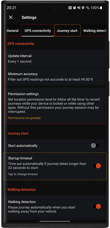
Sometimes the time it takes to find your first GPS signal may vary, and the app may need more than fifteen seconds to receive the first signal. Change the ‘Startup timeout’ setting (highlighted above in amber), to allow more time to find the first signal.
The reason for the timeout is to inform you of why it might be taking so long and what you can do to get a signal faster. Once you are aware of this, you can switch this warning off or set a longer timeout if you’d prefer.
Overcast warnings
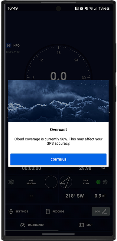
Cloudy skies can affect both GPS accuracy and signal response time– this is a very common reason for slow GPS response times. You will also be notified at the start of a trip if weather conditions are likely to affect accuracy.
Signal Strength Indicator
The three-colour GPS signal indicator is used across the dashboards so you’ll be able to quickly gauge your signal strength at any time.
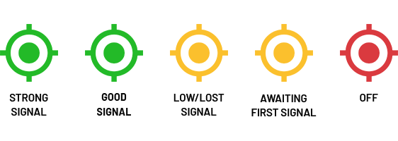
The signal indicators will remain a solid green when a highly accurate signal (within 7 meters/22 feet) has been received in the last second, blink green for less accurate signals (7-15 meters), and will flash amber when an adequate signal has not been received for a more than a 3 seconds. They remain a solid amber until the first GPS signal has been received in the session.
Smart watch connectivity
As smartwatches are a lot smaller and more compact than phones, onboard GPS capabilities tend to be a little slower, which means it can be difficult in many cases to find a strong enough signal to show your speed accuracy and in good time.
The Wear OS apps offer the option to use either the onboard GPS, or to stream from your smartphone over bluetooth if necessary for a faster and more reliable connection. Mariner can connect to your boat’s NMEA 0183 network over WiFi to stream GPS data.
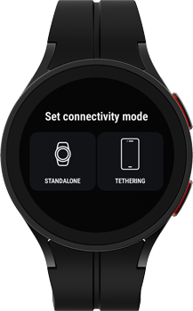
💡 To use this tethering feature, you’ll need to have the same app installed on both the watch and the paired smartphone.
Fault tolerance
Various kinds of problems may occur while recording a journey; RAMS was built with this in mind. Prolonged use of GPS consumes a lot of battery power in most cases, and we all occasionally forget to charge our phones and they run out of juice. Hard-to-find bugs may also be present in complex mobile apps, despite any precautions a development team like ours may take.
In case of runtime failure or the device running out of power the RAMS recording engine is designed to recover gracefully and minimise the loss of journey data. The apps will detect if they were shut down improperly and will pick up right from where you left off before the interruption.
Crashes in the apps are reported to our analytics platform so that we can address them as quickly as possible. These crash reports are completely anonymised and no personal data will ever be included or necessary.
🔗 Learn more about our analytics practices in our privacy policy.
Power efficiency
Processing of GPS and other sensor data, unit conversions, and network calls are made frequently throughout each session in order to display the most accurate data at any given moment. High power usage is necessary to provide such accuracy and give us as users the best possible experience.
Smart Background Processing
We regularly review and monitor app performance to find new ways to improve efficiency. Journey statistics are calculated in the background while a session is underway. The interval at which this data is processed varies throughout longer trips to contribute to lower power and memory usage.
Reducing the GPS update interval is the most effective way to prolong battery life while recording. You change this via the main settings menu; tap on ‘Update Interval’ under the GPS section.
💡 We recommend keeping your devices plugged into a power source while recording with a RAMS GPS Dashboard. The apps will show a reminder of this when a user begins their first session. Check out our Energy Monitor app for help staying on top of your battery status.
Data security
The RAMS Cloud is designed to be a robustly secure place to back up journey data. Everything is compressed and encrypted with the AES standard before being uploaded, and your unique personal encryption keys are stored on your end in a protected Google Drive folder that only the RAMS app can access. This ensures that only a record’s owner will ever be able to read it.
🔗 Learn more in-depth about our cloud security practices.
Better apps for better journeys
We build these apps to be capable of taking on any challenge, and as an independent team of avid explorers, we enjoy using them as much as creating them. We welcome your feedback to help us to improve the RAMS even better.
Download Mariner GPS Dashboard on Google Play:
Download Velocity GPS Dashboard on Google Play:
Follow us on Instagram, Facebook and LinkedIn.