Wayfarer GPX is designed to be a quick estimation tool for travel planning on the go. While planning short flights and sailing trips in new places, we used to find ourselves without a way to know how far we could travel within a time frame of a few hours. From these situations came the idea of building a new app for making off-road journey plans quickly and informally; whether en route or while pre-planning in a bar.
To bring this idea to life we combined the travel time calculation feature from Mariner GPS Dashboard with a compass, and added compatibility with the universal GPX file format. This combination of features would make it easy to create off-road routes on any scale, from your immediate surroundings to anywhere in the world.
This guide explains how to use the latest Wayfarer GPX app to measure distances and estimate travel time.
1. Point-to-point
Wayfarer GPX 2.+
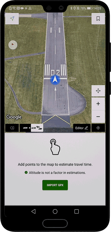
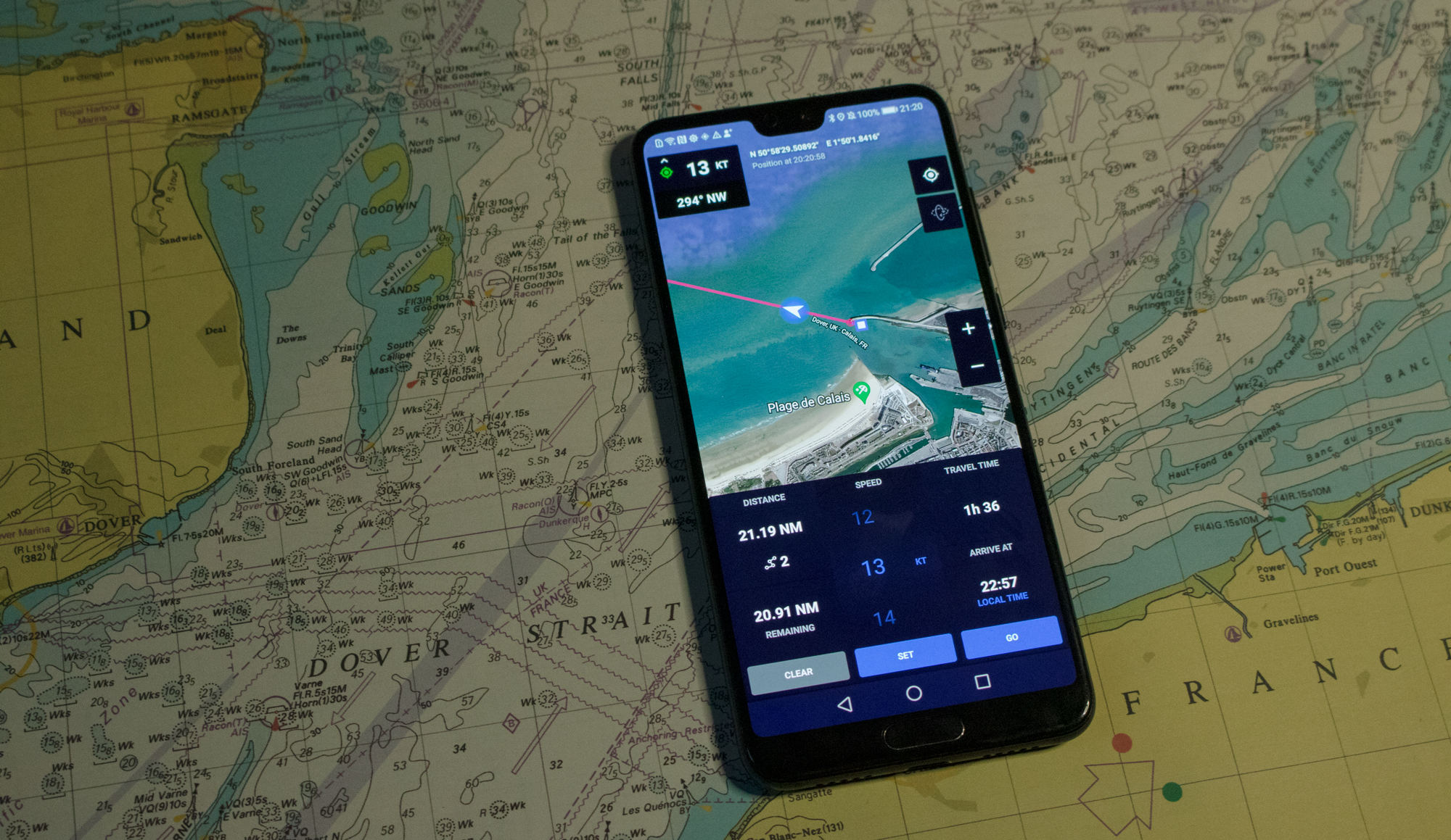
To create a route, tap anywhere on the map to add points, or on the blue arrow marking your location to measure to or from where you are. Once you’ve added two or more points, the calculator panel will appear on the bottom half on the screen. The left panel shows the distance for your route; tap on it to change distance unit. Swipe up and down on the ‘AVG SPEED’ wheel or tap ‘KEYPAD’ to set a speed, and the trip duration and expected arrival time will appear in the right column. Tap on the speed unit to switch between imperial and metric units.

Tap on the vehicle type switch to change between road and air/marine drawing modes. Air/Marine mode (A/M) lets you draw point to point on the map for off-road routes. In road vehicle mode (R) the app will automatically find the most convenient road route between any of the points you add to the map.
🚲 Road routes are optimised for cars by default. In settings, select ‘prefer cycling routes’ to find routes optimised for bicycles instead.
2. Enter addresses/coordinates
Wayfarer GPX 2.+

Open the ‘EDITOR’ menu for more ways to create routes. Tap on ‘Enter address/coordinates’ to enter decimal coordinates, a street address, or a what3words address and add the location to your route.
You can add many locations in succession by selecting the ‘add multiple’ checkbox at the bottom of the popup.
3. Enter what3words addresses
Wayfarer GPX 2.+

what3words is an easy way to talk about any precise location in the world. It gives every 3m x 3m square a unique combination of three words: a what3words address.
On the coordinates/address entry popup, tap on the what3words tab and simply type in a three-word-address to add it to your route.
🔗 Visit what3words and check our full article below to learn more.
4. Add points of interest
Wayfarer GPX 2.+
Long-press anywhere on the map to add a new point of interest. This will create a permanent red marker that you can easily refer to in future. Once you’ve added a marker, tap on it again to add it to your route or to show its details.

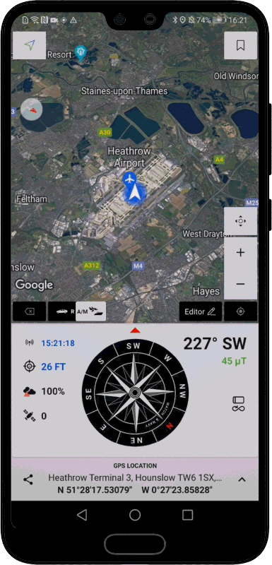
Tap on the bookmark icon (pictured right) to list all the places you’ve saved in order of distance from where you’re looking at on the map (not your current location). Tap on any of the items in the list to show it on the map, or long press on them to show more details or delete.
💡 You can also add notes or a nickname to a saved place.
5. Load GPX files from your device
Wayfarer GPX 2.+
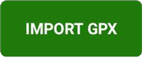
You can load in preexisting files in the GPX format. Tap on ‘IMPORT GPX’ (also in the editor menu) to open the GPX library. Tap on the import arrow in the top-right corner of the screen to choose a file stored on your device. GPX files are automatically added to your library when they are imported or exported.
6. Load GPX files from cloud storage
Wayfarer GPX 2.+
Sign into the app with your Google Account to keep your GPX files backed up with high-security cloud storage. Imported and exported files in your library and will be synchronised automatically. You can sign in on multiple devices to have your files easily accessible from anywhere.
📍 Saved places are also synchronised with your signed in account.
All of your data is encrypted with the AES standard before being uploaded, and your unique personal encryption keys are stored on your end in a protected Google Drive folder. This ensures that only a file’s owner will ever be able to read it.
🔗 Learn about our secure cloud storage service
🔗 Learn more in our privacy policy
Comparison with Mariner GPS Dashboard
Mariner’s Travel Time calculator may appear very similar to Wayfarer GPX at a first glance, however there are key differences. The feature was first introduced in Mariner 2.0 (2019). As the two apps have been built in parallel they have ended up sharing similar design patterns.
Mariner GPS Dashboard is primarily a journey recorder. Wayfarer GPX is a general planning tool for all modes of transport, whereas Mariner is focused on a marine context. Wayfarer GPX also has the widely-compatible GPX file format capability to export new routes and import preexisting ones.
🔗 Learn more about Mariner GPS Dashboard
Here are the key differences between the two apps:
| Feature | Wayfarer GPX 2+ | RAMS Mariner 3+ |
| Record routes | ❌ | ✅ |
| Live average speed | ❌ | ✅ |
| Draw routes on map | ✅ | ✅ |
| Travel time calculator | ✅ | ✅ |
| Follow live route | ✅ | ✅ |
| Export GPX file | ✅ | ✅ Recorded journeys only |
| Import GPX files | ✅ | ❌ |
| Typed location entry | ✅ | ❌ |
| Estimate along roads | ✅ | ❌ |
We’re always working on new ideas to utilise mobile tech to create new possibilities for planning and travel. Your suggestions are always welcome to make Wayfarer GPX even better in future.
We wish you great journeys!
Download Wayfarer GPX on Google Play
Follow us on Instagram, Facebook and LinkedIn.