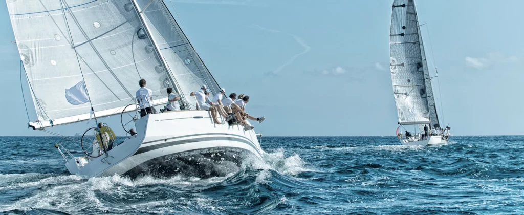
Sailing has always been an endeavour rooted in innovation. The tools that carried ships across oceans also carried food and trade to every shore, making navigation a foundation of global life. Each advance throughout history, from stars to satellites, reflects humanity’s ingenuity and adaptability.
In the days of wooden ships and hand-drawn charts, sailors depended on their knowledge of the skies, weather patterns, and basic instruments like the sextant to reach their destinations. These methods were used for centuries, and while groundbreaking for their time, they often left a lot of room for error, making every journey a testament to human resilience. Over time, advancements in mechanical instruments, electronics, and digital technology reshaped how mariners interact with the sea.
In this article, we’ll trace the fascinating evolution of sailing technology; from ancient tools that relied on the stars to modern devices that connect sailors with satellites in the earth’s orbit . Each era of innovation has played a pivotal role in shaping the experience of being at sea, and together, they illustrate how technology continues to redefine what’s possible on the water.
- Early Beginnings: The Era of Manual Navigation
- The Age of Mechanical Instruments
- The Advent of Electronic Navigation (20th Century AD)
- The Digital Revolution in Sailing (21st Century AD)
- Smart Technologies and the Internet of Things (IoT)
- Sustainable Sailing Technologies
- Challenges and Critiques of Modern Sailing Technology
- Future Trends in Sailing Technology
- Help Shape the Future of Sailing Tech
Early Beginnings: The Era of Manual Navigation

Long before the digital age, sailors relied on the skies and rudimentary tools to guide them across open waters. Navigation during these early days was an intricate dance of skill, observation, and intuition.
The Astrolabe (c. 150 BCE)
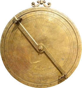
One of the earliest and most significant navigation instruments was the astrolabe, developed by Greek mathematicians and Islamic scholars around 150 BCE. Sailors used an astrolabe to calculate the position of the sun and stars above the horizon. By aligning its rotating arm with a celestial body, they could calculate their latitude and estimate their position at sea. The astrolabe became a popular instrument for European explorers during the Age of Exploration (15th–17th century).
Marine Compass (11th Century AD)
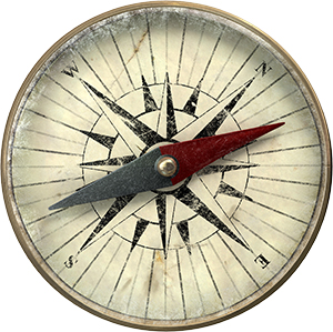
The invention of the marine compass revolutionised navigation at sea by providing sailors with a more reliable reference point in any weather, at any time of day. The earliest documented use dates back to 11th century China during the Song Dynasty, in the form of a magnetised needle suspended in water– known as a ‘wet compass’. By the 13th century it had spread to the Islamic world and Europe where it developed into the ‘dry compass’ we’re most familiar with in the modern day– featuring a pivot-mounted needle within a protective box. This greatly improved the stability and accuracy, making it far more effective for use at sea.
During the Age of Exploration, compasses would often be used in combination with celestial navigation tools such as the astrolabe, and later on the sextant.
Chip Log (16th Century AD)

In the Age of Sail, sailors relied on the Chip Log to estimate their vessel’s speed through the water. Developed in 16th century Europe, this simple device consisted of a weighted wooden board (the “chip”) attached to a knotted rope and measured with a sandglass timer. The chip was thrown overboard, and as it lay afloat in the water the sailors would count the number of knots that passed through their hands within a set time frame. This measurement determined the ship’s speed in Knots, a unit still used in maritime and aviation today. While not nearly as accurate as a modern speedometers, the Chip Log was a crucial tool for dead reckoning and helped sailors to estimate their distance travelled and time to destination when used alongside a compass.
💡 Sailors counted knots over 28 seconds, with each knot spaced 47 feet and 3 inches (14.4 meters) apart, calibrated so that the number of knots counted matched the ship’s speed in nautical miles per hour.
The Sextant (18th Century AD)
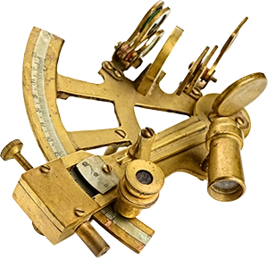
The sextant is a precision instrument invented in the 18th century by British mathematician John Hadley, which allowed sailors to measure the angle between celestial bodies and the horizon. These could determine latitude with remarkable accuracy, although it did come with some limitations: it required clear skies, steady hands, and extensive training to master.
The manual tools of this era demanded skill and precision, and were often prone to error in rough seas and strong winds. These early technologies laid the groundwork for future advancements, but the journey to precise and reliable navigation was only just beginning.
The Age of Mechanical Instruments
As maritime travel expanded during the 18th and 19th centuries, the need for greater accuracy and reliability lead to significant advancements in technology. Thus began the era of mechanical instruments– giving sailors unprecedented precision and making sea travel more reliable and efficient.
The Chronometer (18th Century AD)
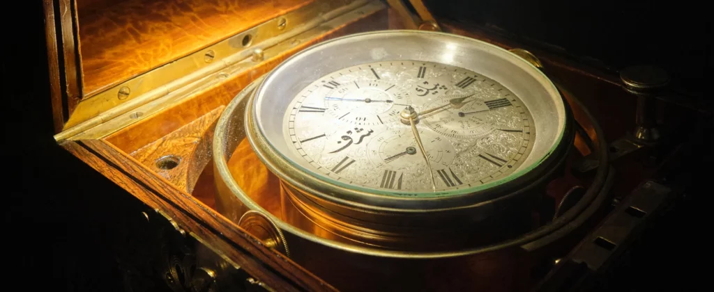
The chronometer, introduced by John Harrison in the mid-18th century, was a game-changer. It solved one of the greatest challenges in navigation: determining longitude. By keeping accurate time at sea, sailors could compare their local time (determined through celestial readings) with the time at a known location, like Greenwich, to calculate their position. This breakthrough drastically reduced the risk of ships veering off course, especially during long voyages.
Taffrail Log / Mechanical Log (19th Century AD)
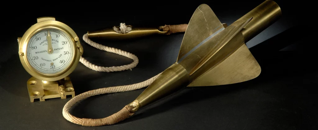
The Taffrail Log is the successor to the Chip Log, introducing a rotating propeller (or spinner) to measure a ship’s speed and estimate distance travelled. On the other end of the line, a mechanical dial displayed speed and distance travelled; far more precise than counting knots by hand. While rudimentary by today’s standards, this was a huge leap in accuracy, reliability, and reducing human error.
These early advancements were not without flaws. Mechanical instruments required meticulous care and frequent calibration, and rough seas could render them ineffective. As maritime technology continued to advance, the transition from mechanical to electronic navigation in the 20th century would soon redefine what was possible at sea.
The Advent of Electronic Navigation (20th Century AD)
The 20th century marked the dawn of electronic navigation, a pivotal shift that redefined the sailors relationship with the sea. Traditional wooden hulls gave way to steel and aluminium vessels, fitted with advanced instruments controlled from the bridge. The transition from mechanical systems to electronic devices brought unprecedented accuracy and functionality, making navigation safer and more efficient than ever before.
Marine Sonar (1910s)
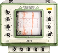
One of the first major innovations in electronic navigation was sonar, a military technology that soon found its way into civilian applications. Sonar enabled sailors to map the ocean floor and detect underwater hazards, revolutionising navigation in shallow or poorly charted waters. Sonar gave sailors the tools to navigate confidently, even in the most challenging environments.
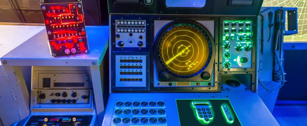
Marine Radar (1930s)
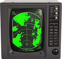
Following sonar came radar, introduced during World War II. Also originally developed for military use, radar allowed ships to detect obstacles, coastlines, and other vessels even in complete darkness. Its ability to “see” through fog, rain, and darkness dramatically reduced the risk of collisions. Over time, improvements in image resolution, range, and automation alerts made radar systems more accessible to both commercial and recreational vessels.
Global Positioning System (1970s)
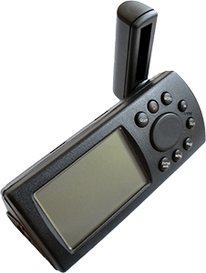
The most transformative development of the electronic era was the Global Positioning System (GPS). Originally developed by the U.S. Department of Defence in the 1970s, GPS was first intended for military use before becoming widely available to the public in the 1980s. GPS offered sailors real-time positioning data with remarkable accuracy down to 3 meters.
Early GPS systems were bulky and expensive, but their impact was undeniable. For the first time, sailors could determine their precise location anywhere in the world, day or night, in any weather condition. As technology advanced, GPS devices became smaller, more affordable, and seamlessly integrated into marine electronics.
These advancements brought a new level of precision to maritime travel, but they also marked the beginning of a shift toward technological dependence. While electronic navigation tools made sailing more accessible and safer, they required sailors to trust machines over traditional methods– a change that would only deepen with the rise of digital technologies in the 21st century.
The Digital Revolution in Sailing (21st Century AD)
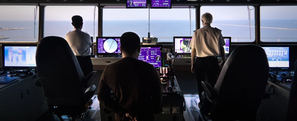
As the 21st century unfolded, the rise of digital technologies reshaped the maritime world. The transition from standalone electronic devices to integrated digital systems created a paradigm shift, offering unprecedented levels of connectivity and efficiency.
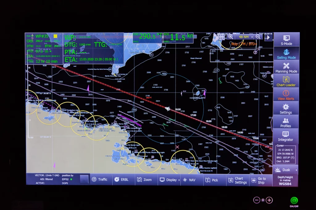
Digital Chart Plotters (1980s)
The introduction of chart plotters marked a significant milestone. These devices combined GPS data with digital maps, providing sailors with visual representations of their location, routes, and surrounding hazards. Unlike traditional paper charts, digital maps on chartplotters could be updated in real time, reflecting changes in tides, weather, and navigational aids. This made planning and executing voyages more dynamic and precise.
Automatic Identification System (1990s)
The Automatic Identification System (AIS) became a vital tool for maritime safety in the 1990s. By transmitting a ship’s location, speed, and heading to nearby vessels, AIS reduced the risk of collisions, particularly in busy shipping lanes or poor visibility. Coupled with radar, AIS made it possible for sailors to gain a comprehensive understanding of their surroundings, even in adverse conditions.
Weather Forecasting
Another leap forward was the emergence of weather forecasting apps. Using satellite data, these apps provided detailed information on wind patterns, wave heights, and storm developments, empowering sailors to adjust their routes proactively. With a smartphone or tablet, mariners could access real-time updates that were once limited to coastal radio broadcasts or onboard barometers.
The digital revolution made navigation faster, more reliable, and user-friendly, opening the doors to recreational sailors and professionals alike. However, it also introduced a reliance on electronic systems that required regular updates, backups, and robust power supplies. These challenges continue to shape the way sailors approach sailing in the modern age.
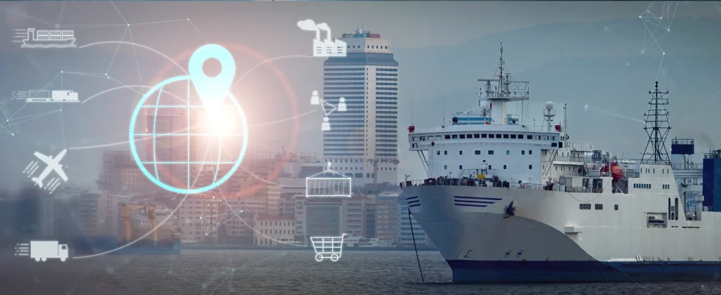
Smart Technologies and the Internet of Things (IoT)
Smart technologies and IoT continue to shape the current era of modern sailing, enabling real-time data analysis, predictive systems, and seamless connectivity between onboard instruments such as GPS, weather sensors, engine diagnostics, and navigation tools. These evolving technologies mark a significant leap from earlier digital systems and lay the foundation for what’s coming next
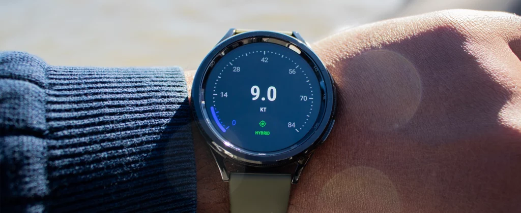
Wearable Technology
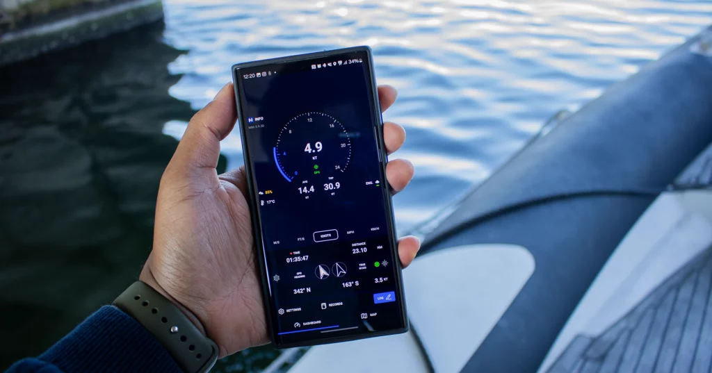
Smartwatches have emerged as essential tools for sailors, offering features tailored to life on the water. Google Wear OS and Apple Watch OS watches offer a variety of apps. for sailors. Devices like the Garmin Quatix series include tide charts, weather alerts, and GPS tracking, all accessible from the wrist. These compact tools allow mariners to keep information close at hand wherever they are on board without needing to access larger systems.
Internet of Things
IoT-enabled systems have also revolutionised onboard monitoring. Smart sensors can track engine performance, fuel levels, and battery health, sending real-time updates to a central hub or a smartphone app. This allows sailors to identify and address potential issues before they escalate, ensuring smoother and safer voyages. Onboard NMEA networks can connect several devices around the vessel and link them to primary displays and smartphone/smartwatch apps.
Autopilot Systems
Connected autopilots have transformed long-distance sailing. These systems, integrated with GPS and IoT networks, can steer a vessel along a pre-determined course with remarkable accuracy, freeing up sailors to take care of other tasks and to rest. Advanced autopilots even adapt to changing conditions, adjusting their settings based on wind direction and sea state.
These new abilities to enhance situational awareness, reduce workload, and improve safety makes them indispensable for the modern sailor. However, despite their benefits even the most modern technologies come with their own set of challenges. They require stable power sources, regular software updates, and protection against cyber threats.
Sustainable Sailing Technologies
Sailing has historically been a sustainable practice, with ships primarily built from wood and powered by the wind. However, the transition to steam and diesel engines, coupled with the constant growth of international trade, has significantly increased carbon emissions over time. In 2023, the global shipping industry accounted for approximately 2% to 3% of worldwide greenhouse gas emissions– a growing concern in the early 21st century.
Initiatives like the Global Maritime Forum’s Maritime 2030 aim to curb these emissions, driving a new wave of cleaner and more sustainable shipping practices. Innovations in this field focus on minimising carbon emissions, reducing waste, and enhancing eco-friendly solutions without compromising efficiency.
Renewable Energy
Electric propulsion has become a leading green sailing innovation, driving the shift toward sustainability. Unlike traditional diesel engines, electric motors generate zero emissions and operate almost silently. Many newer systems also incorporate renewable energy sources—such as solar panels and wind turbines—to reduce dependency on fossil fuels and improve onboard efficiency.
Renewable energy is also transforming onboard power management. Once limited in capacity, solar-powered systems can now generate enough energy to run essential equipment like navigation devices, lighting, and refrigeration, making sailing more self-sufficient and environmentally friendly.
Construction Materials
Materials used in boat construction are evolving. Carbon fibre and recycled composites are gaining traction as durable, eco-friendly alternatives to the fibreglass hulls that dominated the 20th century. Their lighter weight improves speed, handling, and fuel efficiency, making vessels more agile and energy-efficient.
Challenges and Critiques of Modern Sailing Technology

While advancements in sailing technology continue to revolutionise the maritime world, they introduce a new set of challenges. Over-reliance on electronics, high costs, and cybersecurity risks are growing concerns for modern sailors. A system failure or power loss can leave vessels without critical navigation tools, making traditional skills just as important as ever. For this reason, sailors are still trained to use paper charts and manual instruments as a reliable fallback.
Over-Reliance on Technology
One significant issue is the potential for over-dependence on electronic systems. As sailors grow accustomed to the precision and convenience of GPS, AIS, and chartplotters, traditional navigation skills like reading a sextant or interpreting weather patterns are becoming less common. This reliance can become problematic when technology fails due to power loss, system malfunctions, or poor signal coverage. For this reason, many sailing certifications still require knowledge of manual navigation techniques to ensure sailors can operate safely in the absence of digital tools.
The Cost of Innovation
The cost barrier also limits access to advanced technology. While commercial vessels and more affluent sailors can invest in cutting-edge systems, smaller recreational sailors often struggle to afford these tools. This divide creates disparities in safety and efficiency across the sailing community, where those without access to modern navigation and safety equipment may face greater risks at sea.
Navigating Cybersecurity Risks
Cybersecurity is an emerging concern in the age of connected devices. IoT-enabled systems, while convenient, are vulnerable to hacking and data breaches. Autopilot systems, for example, could be exploited to alter a vessel’s course, posing serious safety risks. As maritime technology becomes increasingly interconnected, safeguarding against such threats will require robust security measures, regular software updates, and greater awareness among sailors.
Future Trends in Sailing Technology
The future of sailing technology promises even greater innovation, driven by advancements in automation, real-time connectivity, and enhanced navigational intelligence.
AI and Machine Learning
AI and machine learning are set to transform navigation and decision-making at sea. Smart systems can process vast amounts of real-time data, such as weather patterns, vessel traffic, and ocean currents, to optimise routes and make adjustments dynamically. AI-powered autopilots may soon handle complex scenarios such as collision avoidance in busy waters.
Autonomous Vessels
While still in its early stages, full vessel automation could enable self-navigating ships to complete international voyages with minimal human intervention. By optimising routes in real time and adapting to weather and traffic conditions, autonomous vessels could reduce delays, improve efficiency, and navigate high-risk areas with greater precision.
Advanced Satellite Connectivity
Enhanced satellite connectivity is transforming communication at sea. Services like Starlink already provide global high-speed internet, enabling real-time updates, streaming, and constant shore communication. China’s upcoming Thousand Sails Constellation and Geespace networks aim to expand coverage further. With multiple providers advancing satellite technology, offshore navigation and long-distance voyages are becoming more connected and secure.
Connected Fleets and Smart Shipping Networks
Advancements in satellite connectivity and AI are paving the way for fully connected fleets, where ships share real-time data on weather, traffic, and navigation hazards. Inspired by technologies used in aviation and military networks, this system would give sailors and automated systems unprecedented insights, allowing them to make faster, more informed decisions. In commercial shipping, connected fleets could help prevent bottlenecks at busy ports, optimise routes based on live conditions, and enhance safety by enabling ships to anticipate and adapt to challenges before they arise.
Help Shape the Future of Sailing Tech
From sextants to smartwatches, sailing technology has come a long way, yet the core principles of navigation remain unchanged. Today, innovations like AI-powered insights, connected fleets, and real-time data bring unprecedented precision to the maritime world.
At Watch & Navy, we embrace both heritage and progress, harnessing the latest technology to empower modern sailors in new ways. As the next chapter of sailing technology unfolds, we’re proud to be part of it, and we’d love for you to help shape what’s next. What features would you like to see in the next version of our flagship sailing app, Mariner GPS Dashboard?
.