Mariner GPS Dashboard is composed of the many ideas we’ve come up with while out on our adventures afloat. In our early days of renting small boats without onboard computers, we thought of how convenient it would be to be able forecast how long it would take to get to different islands in the vicinity, and to know exactly how far out we could go before sundown.
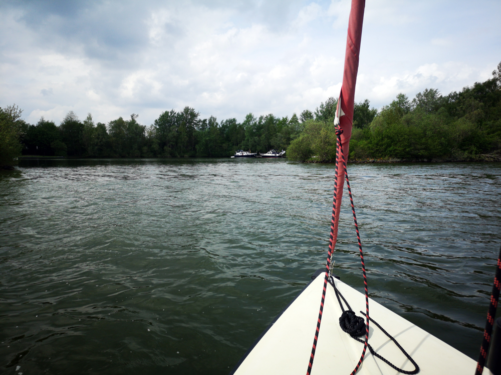
The travel time calculator was imagined during these trips, and is designed to be usable by anyone without any prior knowledge of charts and navigation. This guide explains how to use this feature to make quick estimations based on your real-time and average speeds.
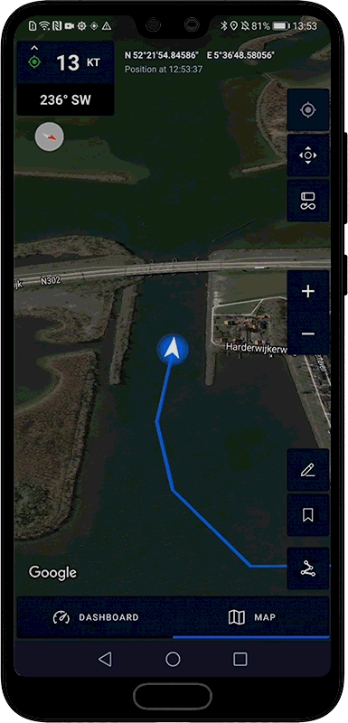
📍 Harderwijk, Netherlands
Simple steps, quick results

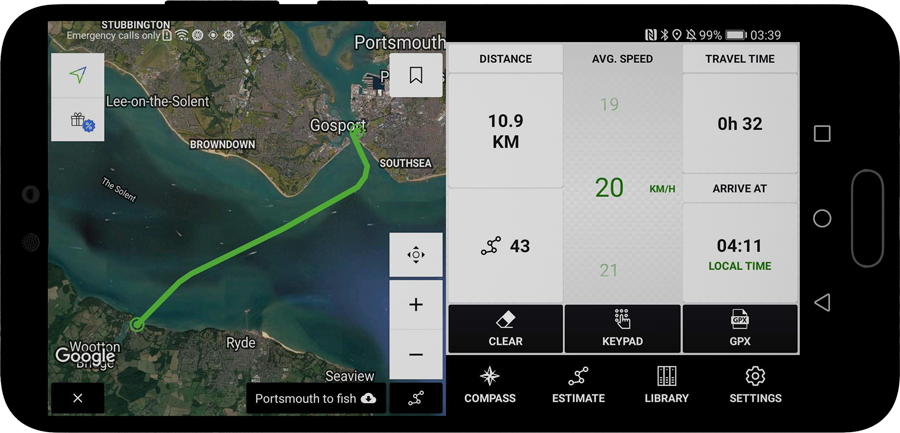
Tap on the route icon in the bottom right corner of the map (pictured right) to activate the drawing mode. An information bar will appear prompting you to start drawing points on the map. Tap on the map to add points and create a route from your current position, and tap on an existing point to remove it from the route.
When you’re done, tap on the ‘ESTIMATE’ button on the info bar to show the travel time calculator panel, which lets you estimate how long it will take you to travel the route and what time you can expect to arrive. Swipe up and down on the speed wheel (blue numbers column) in the middle of the calculator to make estimations at different speed; your current speed will be shown by default. Tap on ‘SET’ to type in a speed using the keypad.
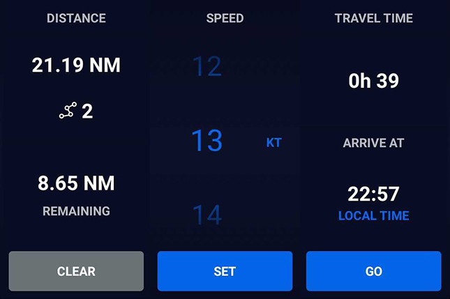
Tap on ‘GO’ on the bottom right corner of the calculator to finalise the route and return to the map. The information bar will now show your elapsed distance, total distance and expected arrival time at your current speed. Tap on ‘ESTIMATE’ again to make another estimation, clear your route, or recenter your active route on the map.

LT stands for Local Time
⚠️ Mariner’s Travel Time Calculator provides estimations only, and is not to be used as a navigation system. Maps do not currently include marine chart information for guidance on safe routes.
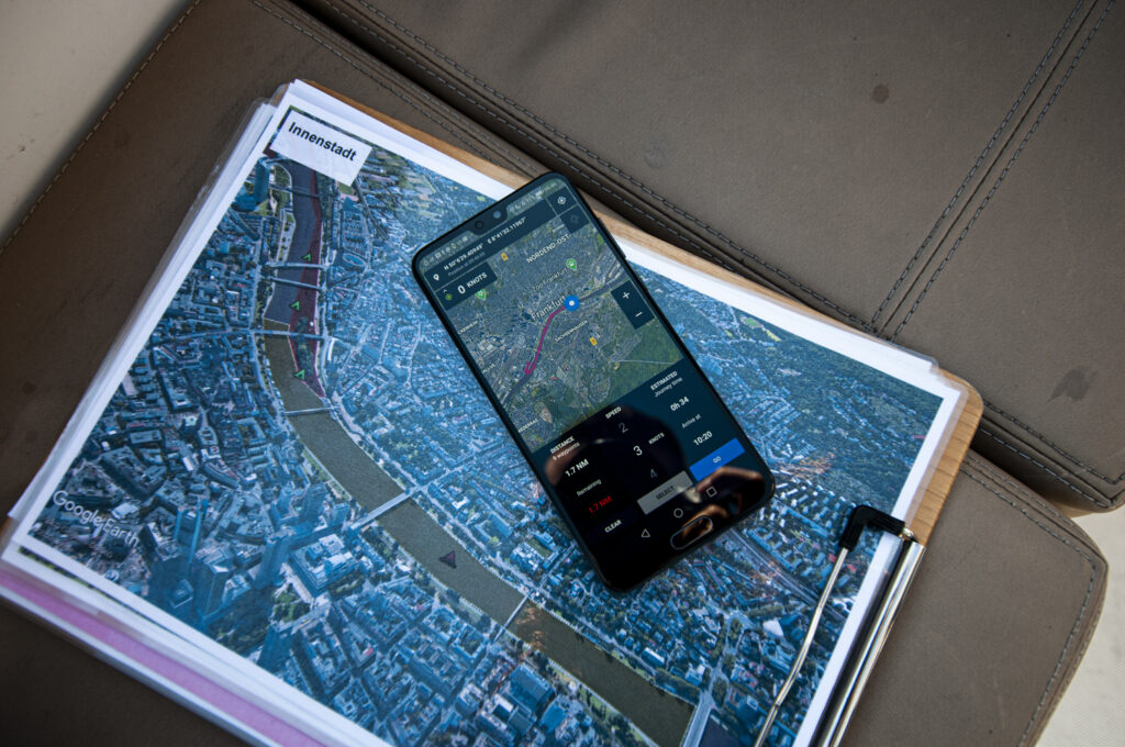
📍 Main River, Frankfurt Am Main
Comparison with Wayfarer GPX
Mariner’s Travel Time calculator may appear very similar to Wayfarer GPX at a first glance, however there are key differences. The feature was first introduced in Mariner 2.0 (2019). As the two apps have been built in parallel they have ended up sharing very similar design patterns.
Wayfarer GPX expands on the original Travel Time Calculator, making it more practical to use as a general planning tool for all modes of transport – land and air as well as marine. The app also has the capability to import GPX files for estimations on preexisting routes, and to export new tracks to GPX for reading in other devices and apps on any platform.
🔗 Learn more about Wayfarer GPX
Here are the key differences between the two apps:
| Feature | RAMS Mariner 3+ | Wayfarer GPX 2+ |
| Record with GPS | ✅ | ❌ |
| Live average speed | ✅ | ❌ |
| Live ETA | ✅ | ❌ |
| Draw routes on map | ✅ | ✅ |
| Travel time calculator | ✅ | ✅ |
| Export GPX file | ✅ Recorded journeys only | ✅ |
| Import GPX files | ❌ | ✅ |
| Typed location entry | ❌ | ✅ |
| Estimate along roads | ❌ | ✅ |
Mariner GPS Dashboard is part of the RAMS (Road Air Marine Speedometers) range of mobile and wearable GPS Dashboards tailored specifically to different modes of transport; Velocity for land vehicles and Mariner for marine vessels.
Our mission is to make new kinds of adventures possible with our range of mobile and wearable apps. Your feedback and suggestions are always welcome to make future updates even better.
We wish you safe and pleasant journeys.
Download Mariner GPS Dashboard on Google Play
Follow us on Instagram, Facebook and LinkedIn.